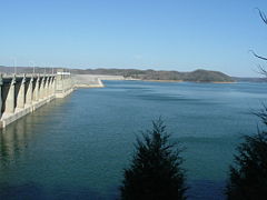
The Lake at Wolf Creek Dam.
The primary reasons for it's construction were flood control and hydroelectric
power.
In 2007, fearing a break in the Dam, the Lake was lowered to a level of 680
feet.
Over 50 years ago, the Army Corp of Engineers built Wolf Creek Dam on the Cumberland River and began the creation of Lake Cumberland. The Lake Cumberland shoreline measures 1,255 miles and the lake is spread over 65,530 acres. The main lake is 101 miles long and over 1 mile across at it's widest point.
|
|
The Lake at Wolf Creek Dam. |
|
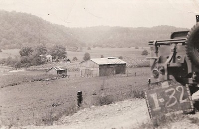
Farm of Shell and Gladys (Gossage) Oatts on Cumberland River. The government numbered properties as they were purchased (note the sign). This farm once belonged to Gladys's uncle, Mace Gossage. The barn was moved to Hwy 1275 before the property was flooded. Submitted by Lisa Oatts New |
|
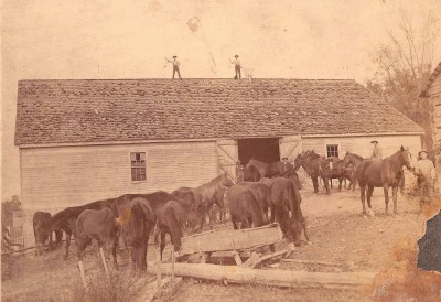
Barn at Oatts Bottom now under Lake Cumberland. This barn was built in 1890 on the Oatts family farm. It was 3 stories that included a basement. Now that the lake has been lowered, the foundation is once again visible. Submitted by Lisa Oatts New |
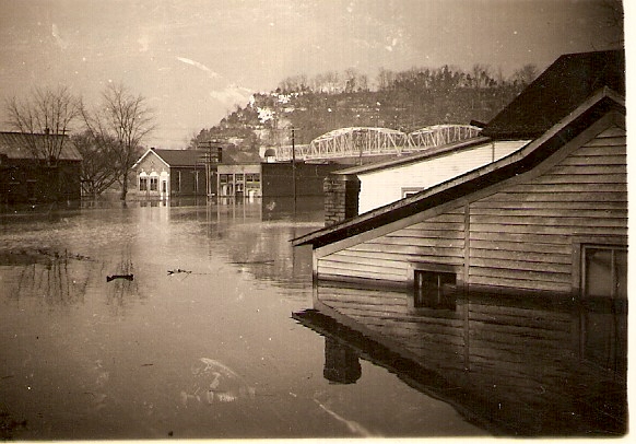 |
It wasn't only farmland that was flooded, sometimes whole communities were lost to the Lake.
Some of the communities lost were Long Bottom, Lula, Horse Shoe Bottom, and
Stokes. Long Bottom was the first community to have to leave their homes,
churches, and schools. In the background you can see the tunnel and bridge of old Route 27. Probably taken at Burnside, KY. |
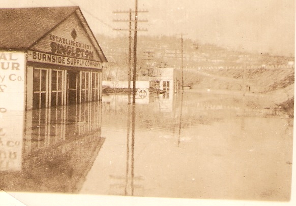 |
The Burnside Supply Company as it was being swallowed up by the Lake |
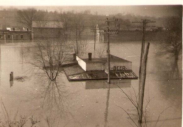 |
The Lake as it approaches the roof tops of abandoned buildings. |
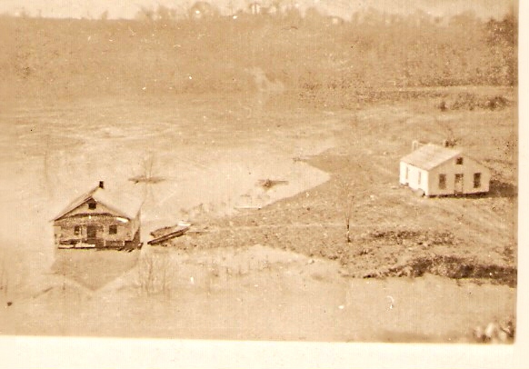 |
Flooding the bottom lands....farms and fields. |