|
|
|
Addresses Other Greenup County Genealogy Sites Links Origins & Neighbors Migration Genealogy Resources For Sale or Wanted |
|||
|---|---|---|---|---|---|
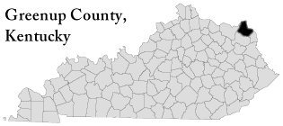
Welcome to the Greenup County Kentucky Genealogy site for the KYGenWeb. Greenup County was formed by an act of the General Assembly of Kentucky on December 12, 1803 from Mason County. It is located in the Eastern Coal Field region of the state. This region covers the eastern end of the state, stretching from the Appalachian Mountains westward across the Cumberland Plateau to the Pottsville Escarpment.
As of 1990, the county population was 36,742 in a land area covering some 346 square miles, an average of 106.2 people per square mile. The county seat is Greenup. Greenup County was named for Christopher Greenup (1750-1818), who served as a Kentucky representative to Congress, and was later elected governor of Kentucky in 1804. |
|||||
|
|||||
To adopt
this site contact State Coordinator:
Jeff
Kemp
© 1999-Present KYGenWeb
This site last updated:
April 03, 2023 10:11 AM